Practical one‑day road‑trip itinerary from Grand Baie along the north coast of Mauritius, with suggested stops, transport options, activities at sea and on land, seasonal notes and sourced references to check before you go.
Quick introduction
This page presents a local route centered on Grand Baie and the northern coastline, intended for a half‑day or full‑day outing. The route covers Grand Baie, Pereybère, Mont Choisy, Trou aux Biches (optional), Cap Malheureux and nearby coastal villages. The content is informational: the site is an independent media publisher, not a local operator or booking service.
Readers will find a suggested sequence of stops, highlights at each location, practical access options, seasonal considerations and links to operators and official references cited below.
Map and suggested step‑by‑step itinerary
Suggested route: depart Grand Baie, head east to Pereybère, continue south along the coast to Mont Choisy, then follow the B13 coastal road north to Cap Malheureux. Return via the coastal road or retrace the same line. The B13 coastal route is recommended for scenery between Grand Baie and Cap Malheureux. See the road‑trip overview on Mauritius Explored for mapped references: mauritiusexplored.com (consulted 07/09/2026).
Time on the road is short between adjacent coastal towns; the B13 links Grand Baie to Cap Malheureux in roughly 15 minutes by car according to local itinerary descriptions. This passage is noted as a short drive on RentCar.mu: rentcar.mu (consulted 07/09/2026).
Variant by sea: departures for catamaran trips and snorkeling excursions leave from Grand Baie / Pointe des Régates. Operators run half‑day and full‑day tours to nearby islets such as Coin de Mire, Île Plate and Îlot Gabriel. For operator details and program examples see Blue Safari: blue-safari.com (consulted 07/09/2026).
What to see and do — points of interest
Grand Baie
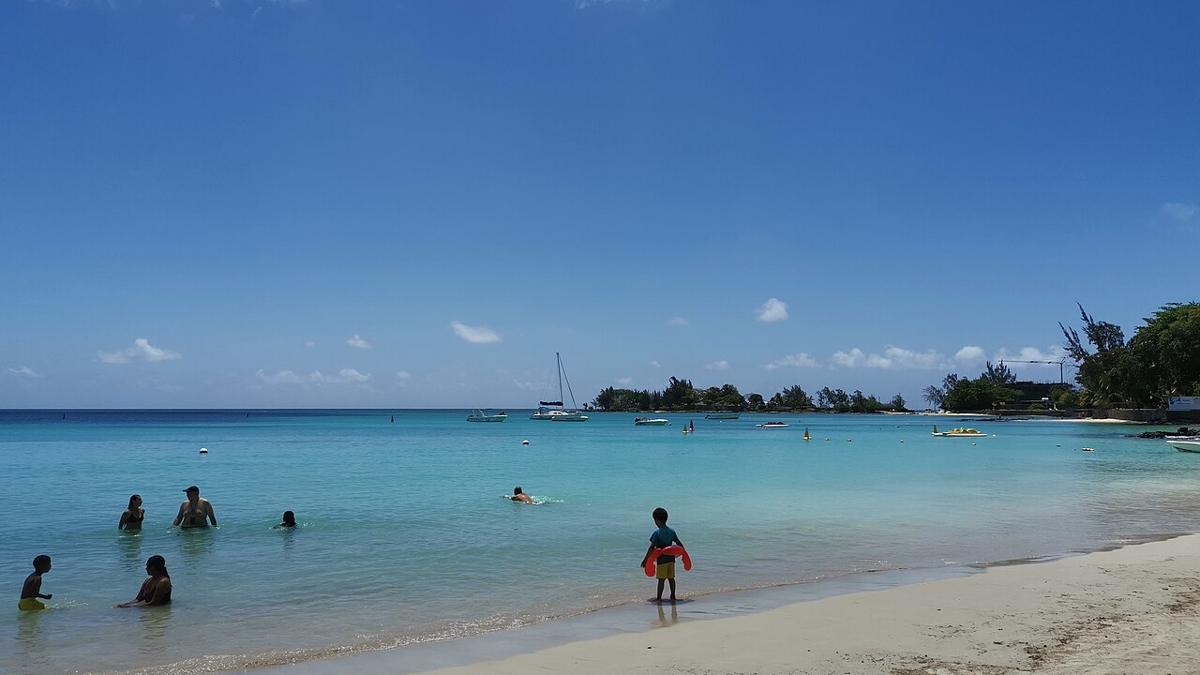
Grand Baie features a sandy beach and calm lagoon, a seafront promenade and a compact stretch of restaurants and nightlife along the coast. The beach and lagoon are described on Mauritius Explored: mauritiusexplored.com (consulted 07/09/2026).
Pereybère
Pereybère is a small coastal village east of Grand Baie. The beach is known for calm waters and public access. See the local description on Wikipedia: fr.wikipedia.org (consulted 07/09/2026).
Mont Choisy
Mont Choisy offers a long shoreline and a wide lagoon that is often recommended for a quieter beach experience. Pack Lightly provides a visitor overview and practical notes: pack-lightly.com (consulted 07/09/2026).
Cap Malheureux
Cap Malheureux is notable for its small red‑roofed church and panoramic views toward offshore islets. It is a coastal landmark on north‑coast drives. See the road‑trip summary on Mauritius Explored: mauritiusexplored.com (consulted 07/09/2026).
Activities at sea
Catamaran tours and snorkeling trips operate from Grand Baie. Excursions commonly visit Coin de Mire, Île Plate and nearby islets for snorkeling and island stops. Operator information and tour formats appear on Blue Safari: blue-safari.com (consulted 07/09/2026).
Access — how to get there
By car
Driving is the most direct way to link the northern coastal towns. The B13 is the main coastal route connecting Grand Baie and Cap Malheureux and is often recommended in local itineraries. RentCar.mu compiles a one‑day road‑trip guide that describes this link: rentcar.mu (consulted 07/09/2026).
By taxi or transfer
Taxis and airport transfer services are available. The official taxi fare schedule for 2026 is published by the airport association; consult the PDF for up‑to‑date fare tables rather than a single quoted price: mauritius-airport.atol.aero (consulted 07/09/2026).
By bus
Interurban bus lines connect Port Louis to Grand Baie and other northern stops. Rome2rio lists route options and practical connections; for current timetables consult local transport providers: rome2rio.com (consulted 07/09/2026).
Parking
Parking is sometimes available near key sites such as the church at Cap Malheureux. Parking availability and rules vary by site and by season. RentCar.mu notes parking examples in its north road‑trip guide: rentcar.mu (consulted 07/09/2026).
When to go — seasonality and safety notes
General climate
Mauritius has a tropical climate. Peak tourist periods and typical seasonal patterns are summarized in travel timing guides. For timing and climatic context consult Tripbase and the Mauritius entry on Wikipedia: tripbase.com (consulted 07/09/2026) and en.wikipedia.org (consulted 07/09/2026).
Cyclone season
The island has a cyclone season. For active warnings and forecasts consult official meteorological services and government documents. Environmental assessments reference cyclone considerations; see Government of Mauritius environment pages and EIA reports: environment.govmu.org (consulted 07/09/2026).
Do not rely on this page for real‑time weather or storm alerts. Check official meteorological sites before travel in high‑risk months.
Costs and references for prices
Taxi fare schedule 2026
An official taxi fare document for 2026 is available from the airport taxi association. Consult the published PDF for current fare brackets and conditions instead of single‑figure estimates: mauritius-airport.atol.aero (consulted 07/09/2026).
Boat excursions
Prices for catamaran and snorkeling tours vary by operator, season and included services. Operator pages present program details and indicative rates; check each operator for the latest offers. Example operator page: blue-safari.com (consulted 07/09/2026).
Note on price variability
Tour and transfer rates change with season and demand. Verify prices directly with operators or with official fare documents before booking.
Practical tips and local rules
Swimming and snorkeling
Select beaches with calm lagoons for supervised swimming and for easy snorkeling access. The beaches listed here are described as suitable for bathing and snorkeling in the cited sources: Grand Baie, Pereybère, Mont Choisy and Bain Boeuf (see Mauritius Explored and Pack Lightly references: mauritiusexplored.com ; pack-lightly.com consulted 07/09/2026).
Respect for the environment
Avoid touching coral and marine life. Carry out waste and avoid leaving litter on beaches. Some northern islets and reefs may be subject to protection measures; consult operator briefings and local authority signage.
Local regulations and safety
Follow signage at beach access points. Operators and local authorities provide the latest safety instructions for sea activities. This page provides factual orientation; rely on operator briefings and signage for specific safety rules.
Useful links and official contacts
- Mauritius Explored — Roadtrip Northmauritiusexplored.com · consulted 07/09/2026
- Mauritius Explored — Grand Baie beach pagemauritiusexplored.com · consulted 07/09/2026
- RentCar.mu — one‑day north road‑triprentcar.mu · consulted 07/09/2026
- Blue Safari — catamaran toursblue-safari.com · consulted 07/09/2026
- Pack Lightly — Grand Baie overviewpack-lightly.com · consulted 07/09/2026
- Pereybère — Wikipediafr.wikipedia.org · consulted 07/09/2026
- Taxi fare 2026 — airport PDFmauritius-airport.atol.aero · consulted 07/09/2026
- Port Louis to Grand Baie — Rome2riorome2rio.com · consulted 07/09/2026
- Environment / EIA chapter — Government of Mauritiusenvironment.govmu.org · consulted 07/09/2026
Frequently asked questions (quick)
How long does the coastal loop take?
Distances are short along the north coast and the B13 links Grand Baie to Cap Malheureux. Exact total duration depends on stops and traffic; see the itinerary paragraph and RentCar.mu for a one‑day plan: rentcar.mu (consulted 07/09/2026).
Can I snorkel from Grand Baie?
Yes. Excursions and snorkeling trips depart from Grand Baie; operators visit nearby islets and reef sites. See Blue Safari for tour formats: blue-safari.com (consulted 07/09/2026).
Are there public beaches?
Yes. Grand Baie and Pereybère are listed as public beach accesses in the cited guides and descriptions: mauritiusexplored.com ; fr.wikipedia.org (consulted 07/09/2026).
What we do not know
- Current unit prices for most catamaran excursions unless an operator publishes a concrete rate on their public page. Do not rely on this page for specific excursion prices.
- Exact duration and kilometre total for a single standard “north loop” because no single official source provides a definitive figure.
- Exact taxi fares for a given trip between Port Louis and Grand Baie when multiple fare tables exist; consult the 2026 taxi fare PDF for applicable brackets: mauritius-airport.atol.aero (consulted 07/09/2026).
- Daily or seasonal visitor counts for individual beaches; no authoritative daily attendance statistics were available in the cited sources.
Editorial disclaimer
This page is an informational guide published by a media outlet. Facts above are drawn from the cited sources (URLs and consultation date 07/09/2026). Verify schedules, prices and safety details directly with operators and official services before travel. This page does not act as a booking platform or a local service provider.
Businesses closest to Grand Baie
Quick answers
Which side of the road do you drive on in Mauritius?
On the left.
How many businesses does the directory list?
293 entries in 48 towns: 140 rental desks, 147 dealers and 5 scooter hirers.
More in this section
- Best Mauritius Self-Drive Road Trips
- Flic‑en‑Flac road trip — West Coast beach day
- Chamarel to Black River Gorges road trip guide
- Belle Mare road trip: one-day stop on Mauritius east coast
- Driving to Port Louis, Mauritius — practical guide
A question? Describe it here
Tell us what you are looking for: we pass your request on to a business free of charge.